View controls
Turn
Move
Everything here is where it really is.
One scale, and it is the true one: the globe is the Earth's own
radius, and every orbit is drawn at the height it is really flown at.
A station four hundred kilometres up hugs the surface, because that is
what four hundred kilometres looks like against a planet twelve
thousand across, and the geostationary ring stands six and a half
radii out where it belongs. The Moon is at its real distance and its
real size. Every position is worked out from the elements each object
publishes, at the moment on the clock. The one thing not to scale is
the marks: a satellite is a few metres across and would be smaller
than a single pixel from any distance worth watching from, so each is
drawn as a dot of a fixed size. There is no scale bar, on
purpose.
Directions are true. Distances are not.
From Parker Solar Probe's closest approach to Voyager 1 is 3700 to 1,
and no single picture holds both. Each distance from the Sun is
compressed by a square root, so the outer planets are pulled in - far
enough to be reached by the zoom, not far enough to crowd the orbits
together. Every figure quoted in kilometres is the real one. Each body
is turned the way it really is turned, tilt and all. The Earth's
neighbourhood is the one exception: the Moon and the craft at L1 and
L2 are drawn further out from the Earth than the compression puts
them, because the compression puts them inside it. There is no scale
bar, on purpose.
Here the distances are true.
This is one body and the craft that stay with it, drawn to one scale:
the globe is its own radius, and every orbit around it is at the
height it is really flown at. An orbiter two hundred kilometres up
hugs the disc because that is what two hundred kilometres looks like
against a planet three thousand across. A rover is on the spot it
landed on, turning with the ground under it. Nothing here is pulled in
to fit. Wind all the way out and the Solar System is offered back,
compression and all.
OrbitalMap a live chronicle of orbit
-
objects
-
sunlit
-
in Earth’s shadow
-
fps
--:--
Wikipedia
Handbook
About OrbitalMap
OrbitalMap shows what is in orbit around the Earth right now. The catalogue of tracked objects - working satellites, spent rocket stages and debris - is published by CelesTrak as orbital elements, and every position is worked out in your own browser, which is why the map keeps moving after the connection drops.
Around the satellites it carries the ground they left: active and retired spaceports, the launches already flown and the ones still scheduled, the weather over the pad in the hours around a window, fireballs caught by sensors on the way down, and the news that follows all of it.
A figure that was measured is credited to whoever measured it; a figure we worked out ourselves - altitude, speed, the time an object next passes over you - says so where it is shown. Every source is public, and all of them are listed under Sources and licences.
The map is free to use, shows no advertising and sets no cookies of its own; it is paid for by donations. Page views are counted by Cloudflare, which is told the page and how fast it loaded and nothing that identifies the reader. It reads in every language listed at the top of Settings.
How to use the map
Everything is one page: a globe you turn, a panel on each edge and a clock along the bottom. Nothing here asks for an account. Your settings and your exact position stay in the browser; when the page puts a name to where you are, all it sends is a position rounded to a tenth of a degree. What follows is all of it, in the order a reader tends to meet it.
The globe
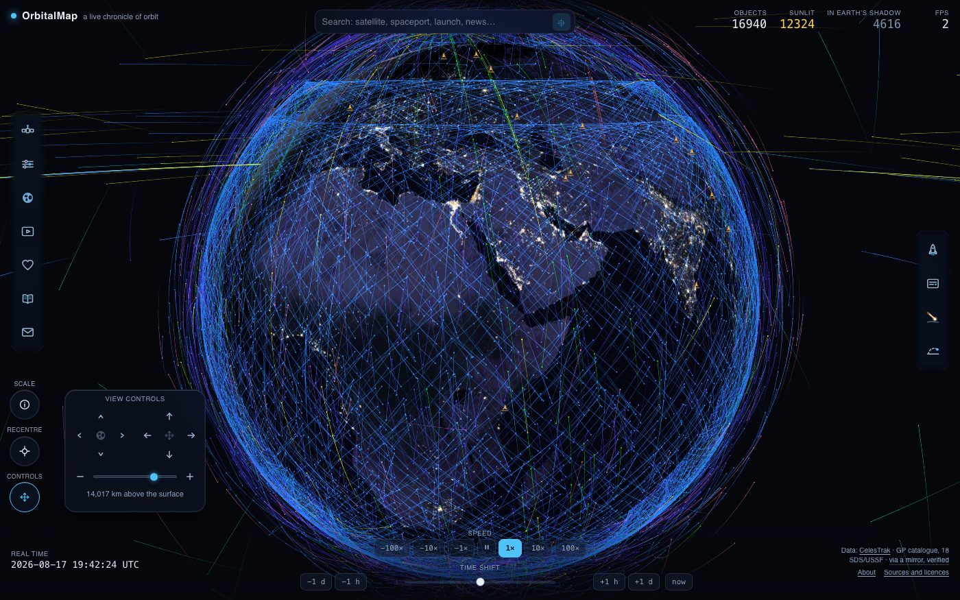
Drag to turn the planet, scroll or pinch to change height, hold shift or use the right button to slide the whole picture aside, and rest the pointer on a moving dot to be told what it is. The figures along the top count what is being worked out at this moment: every object in the catalogue, how many of them are in sunlight, and how many are in the Earth’s shadow. Sunlight is the first condition for seeing one from the ground, though not the only one: it must also be above your horizon, bright enough, and against a sky dark enough to show it.
The camera, without a mouse
Not every picture is easy to reach with a hand on a trackpad, and a touchscreen has no scroll wheel at all. So there is a small pad near the bottom of the left edge: a cross that turns the view, a cross that slides it, and a slider for the distance with a step either side. Underneath, it says in plain figures how far away the camera is - kilometres above the surface on the globe, astronomical units out in the Solar System. Two round buttons stand in the corner beside it. The lower one folds the pad away when you would rather have the corner, and unfolds it again; the upper one recentres the camera, and stays where it is whether the pad is open or not, because needing it is not a good moment to have to find something else first. That button is also the way back from anything you are following: if the camera is riding a satellite, standing on a place or has been shoved off centre, it lights up, and pressing it puts you back where the view began. The pad also answers your hand: drag, shove or zoom the picture with a mouse, a trackpad or a finger and the arm that stands for what you are doing lights up, which is the shortest way of saying that the two are one control.
On a phone there is one more: the two rows of buttons along the bottom and the clock under them fold away behind the small HIDE button that sits above them, which gives the map about a third of the screen back. Pressing it again brings them up, and the page remembers which you left it at.
Finding something
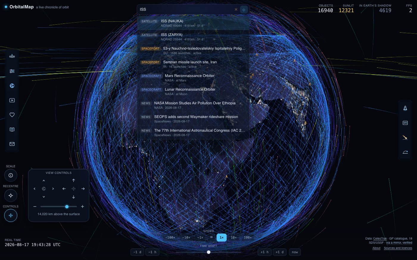
One box searches the whole page: satellites by name or catalogue number, spaceports, launches and news, each answer labelled with what it is. The / key puts the cursor in it from anywhere. Where you are is set in the settings card, and the sky strip in the top bar opens the patch of sky above it - the pass list and that patch are both built on the position, which is kept only if you name the place yourself and never leaves the page except rounded to about a kilometre.
The card of an object
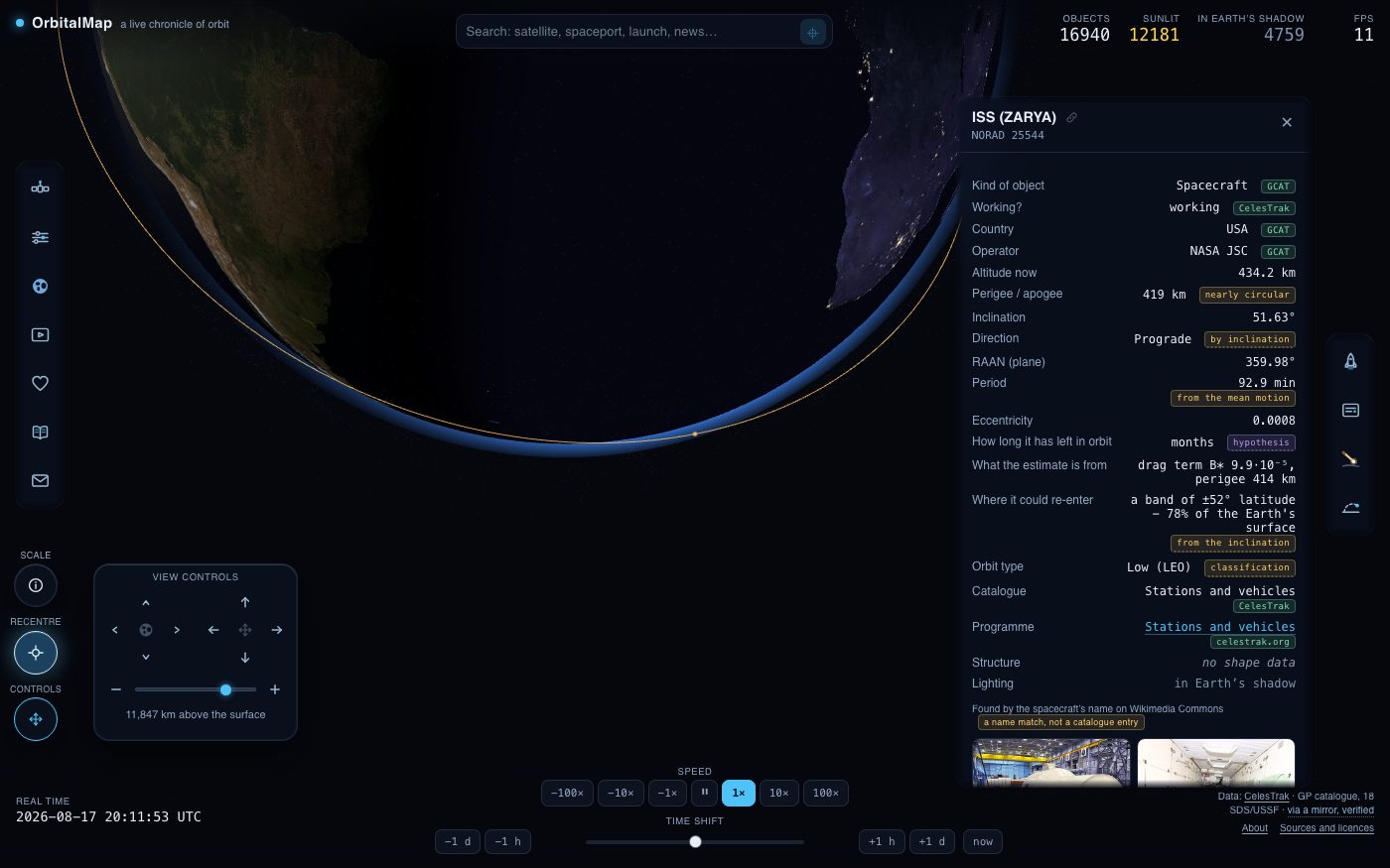
Choosing a satellite opens its card: what it is and what it is for, who owns it, when and from where it went up, and where it is at this second. A figure that was measured is credited to whoever measured it, and one worked out here is marked as ours. The button marked “fly right up” locks the camera to the object; Escape gives the planet back. If what you chose has wandered out of the frame - because you slid the picture aside, or wound the distance out - the foot of the card offers to bring it back into view, and stops offering once it is in the middle again.
The ground
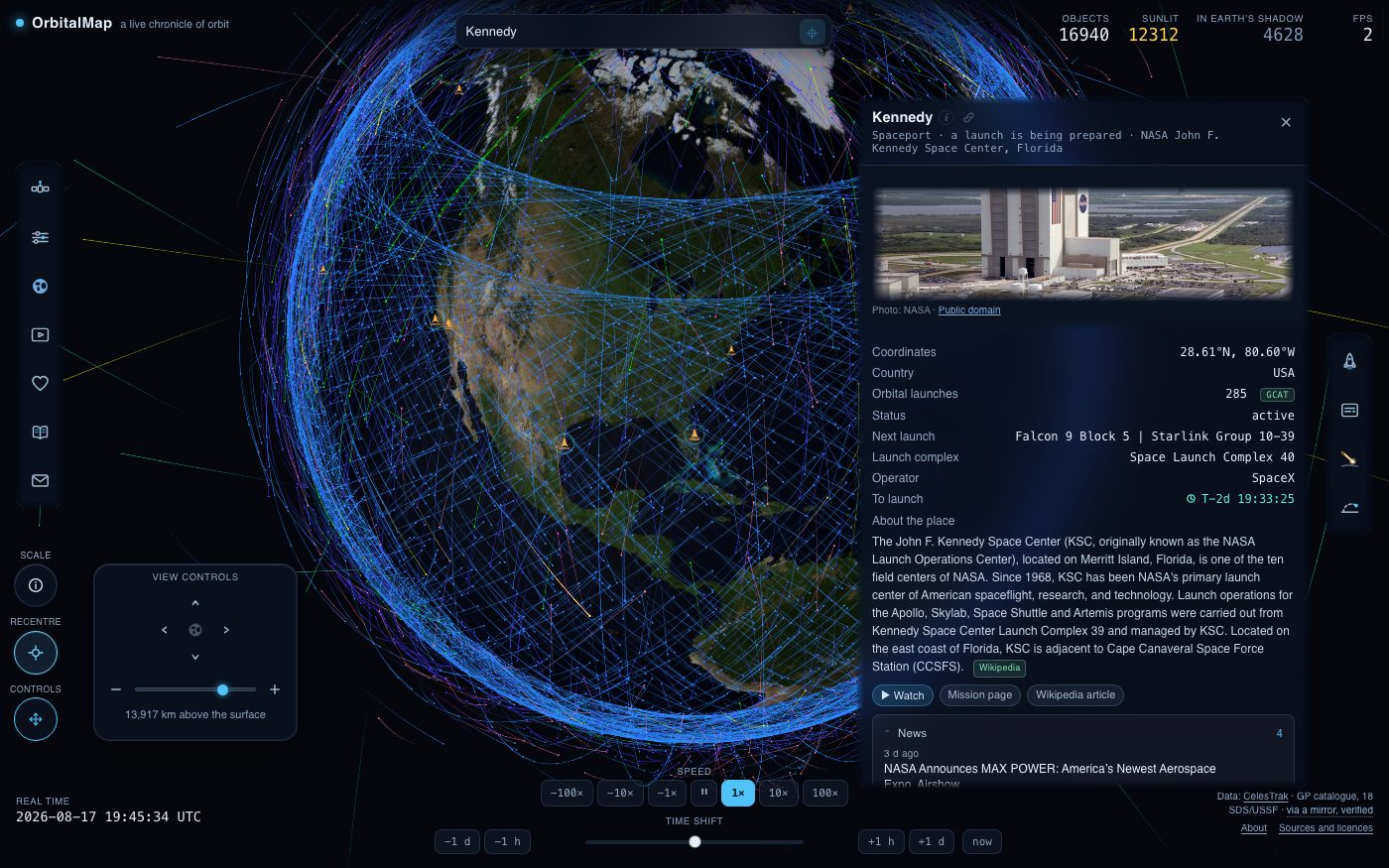
The cones on the map are launch sites, active and long retired. Their cards carry what has flown from there and what is still to fly, the weather over the pad in the hours around a window, and photographs where a licence allows them to be shown.
Filters: what is drawn
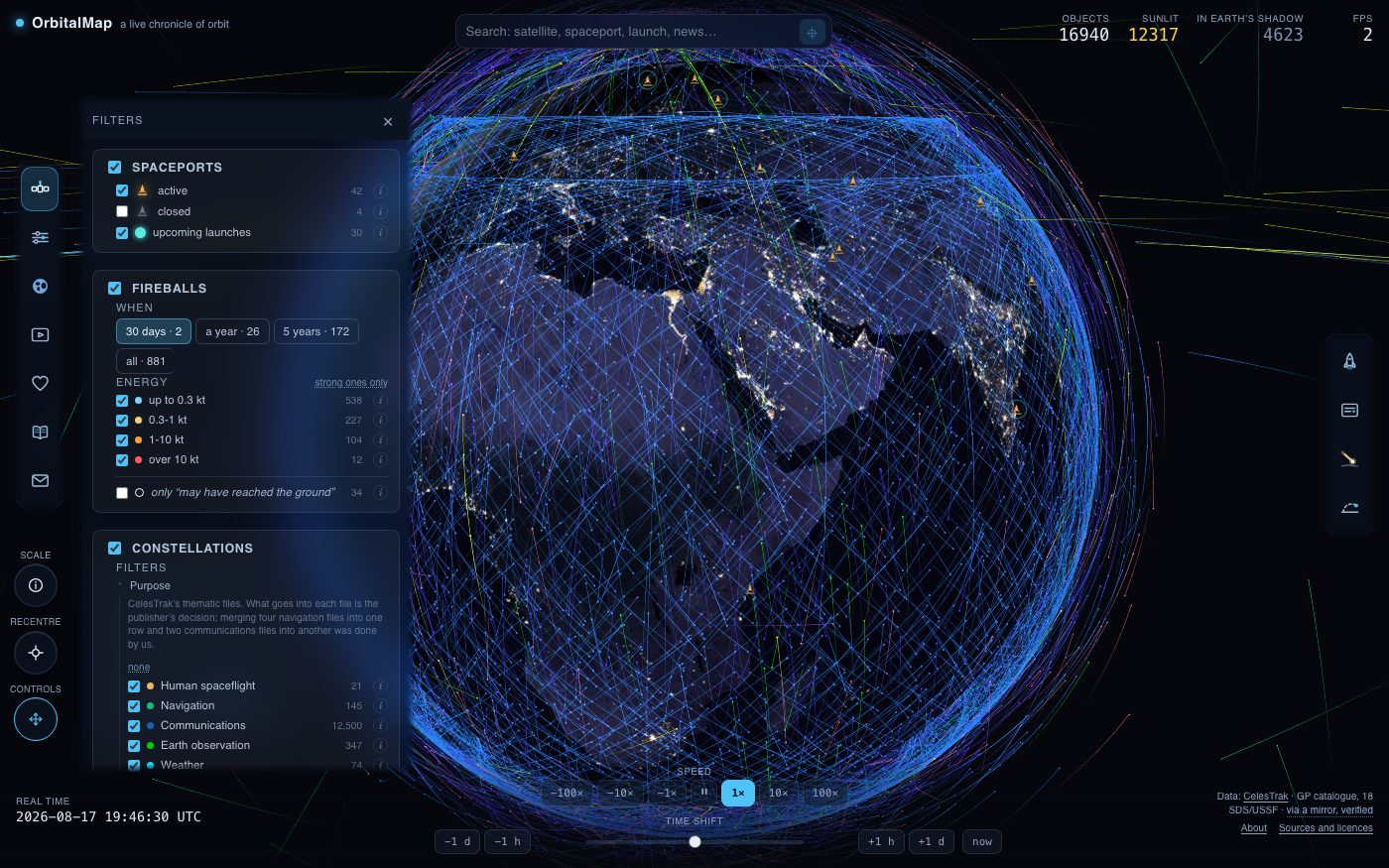
The Filters button on the left edge decides what the globe shows: spaceports, the launches still to come, fireballs by energy and by date, and the satellites themselves by group - purpose, constellation or country, whichever the colour is set to. Every row carries its own count, so a filter says how much it is hiding.
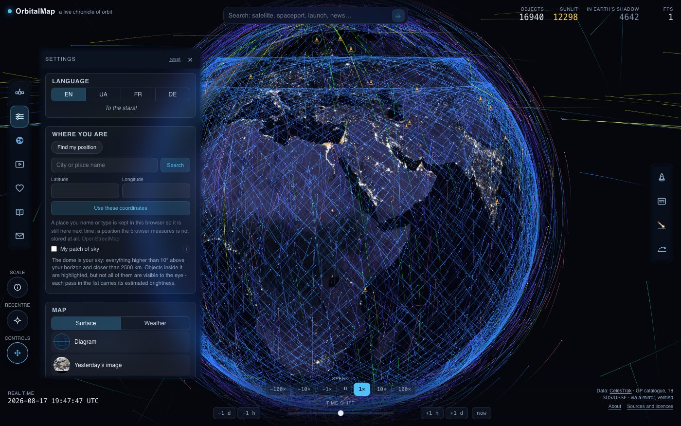
Settings: the map and the sky
Settings holds everything about the picture rather than about the data: the surface - a diagram, yesterday’s satellite image, a cloud-free photograph or the relief and sea floor - the weather layers over it, city lights, the night side, the aurora forecast, eclipse shadows, the Sun, the Moon, and how fast the globe turns and how far away it sits. Each row says what it is: measured, calculated or forecast.
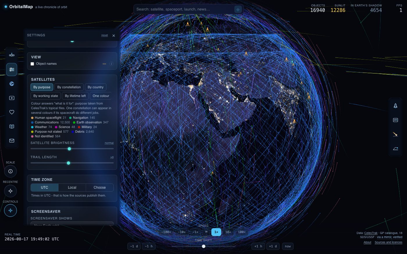
Colour, and the time zone
Satellites can be coloured by what they are for, by constellation, by country, by how much working life the orbit has left, or all in one colour; the legend doubles as a census. Brightness and trail length are here too, and so is the time zone every date on the page is shown in - UTC as the sources publish it, your own, or one you pick.
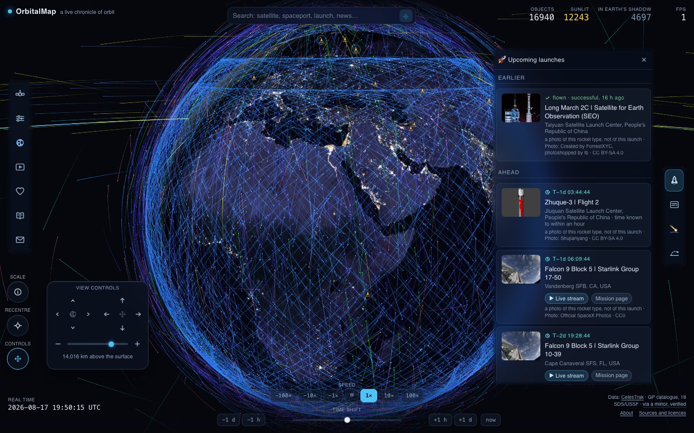
Launches
The top button on the right edge opens the launch board: what is next, from where, on what, and how the window looks from the pad. A launch on the list is a place on the globe - open one and the map goes there.
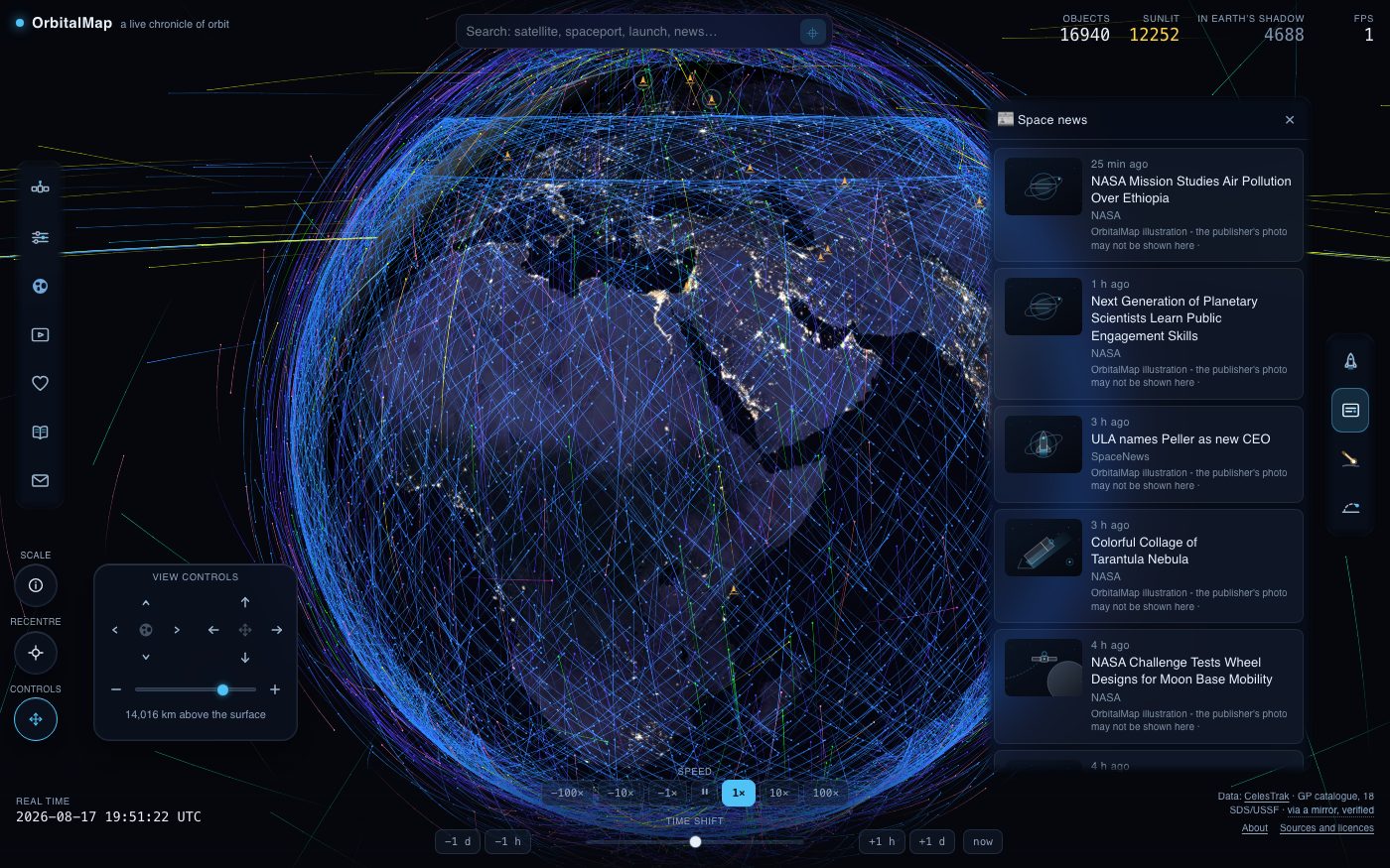
News
The space press of the last few days, newest first. A headline opens as a card with its source and a link out; where a publisher does not licence its photograph, the picture beside the story is our own illustration and says so.
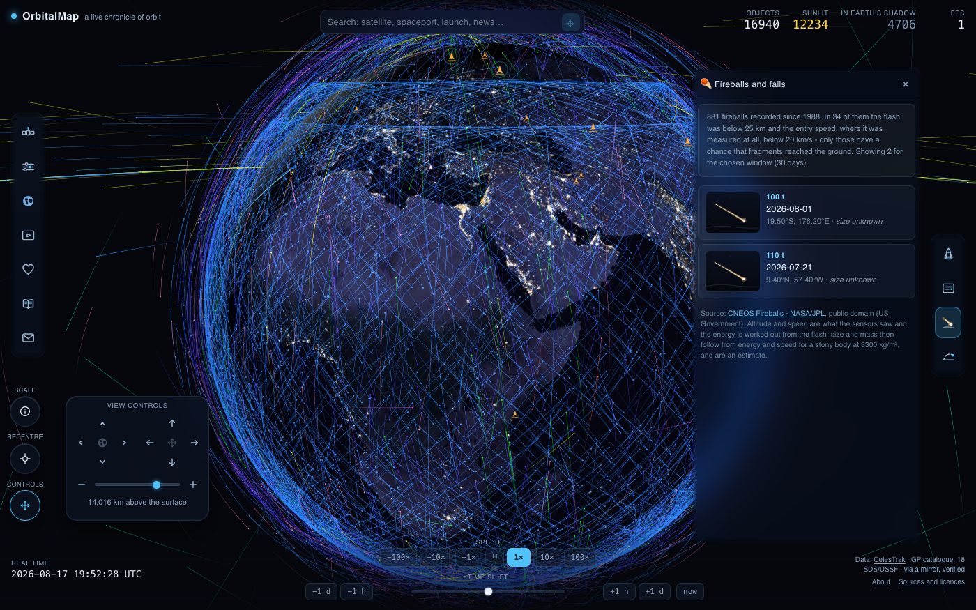
Fireballs and falls
Bright meteors caught by sensors on their way down, back to 1988, placed where they were seen and sized by the energy released. Only the few that burned low enough are marked as having had any chance of reaching the ground; size and mass are an estimate and are labelled as one.
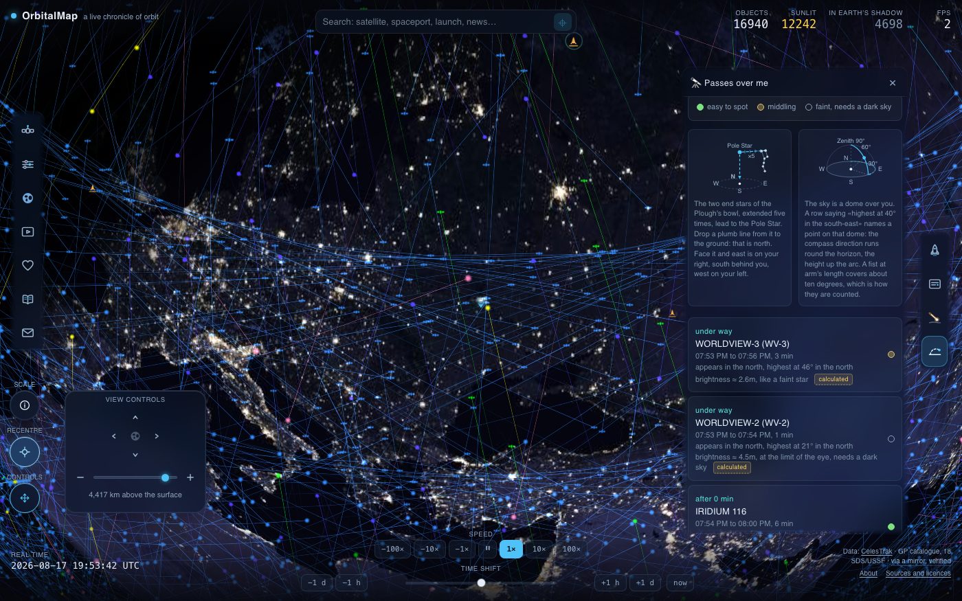
The sky over you
Once the page knows where you are, it works out when the brighter satellites cross your sky: when a pass starts, how high it climbs, where to look, and how bright it should be. Passes in daylight or in the Earth’s shadow are marked, because those are the hard ones - usually impossible, and never the ones to go out for. Above the list stand the things that decide whether the list is any use at all: the cloud forecast, sunset and sunrise, the Moon with its phase, and the planets that will be up after dark.
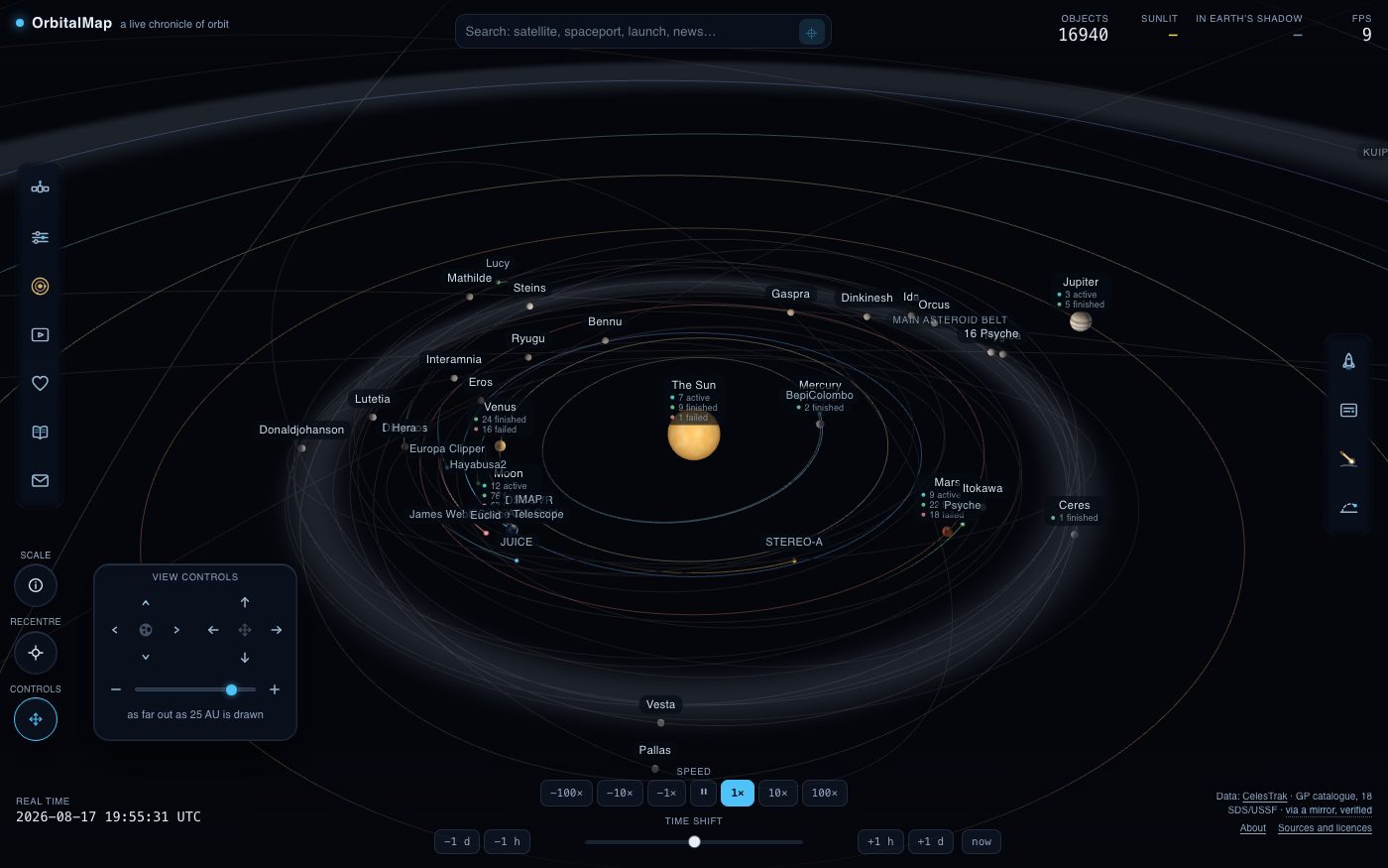
Out to the Solar System
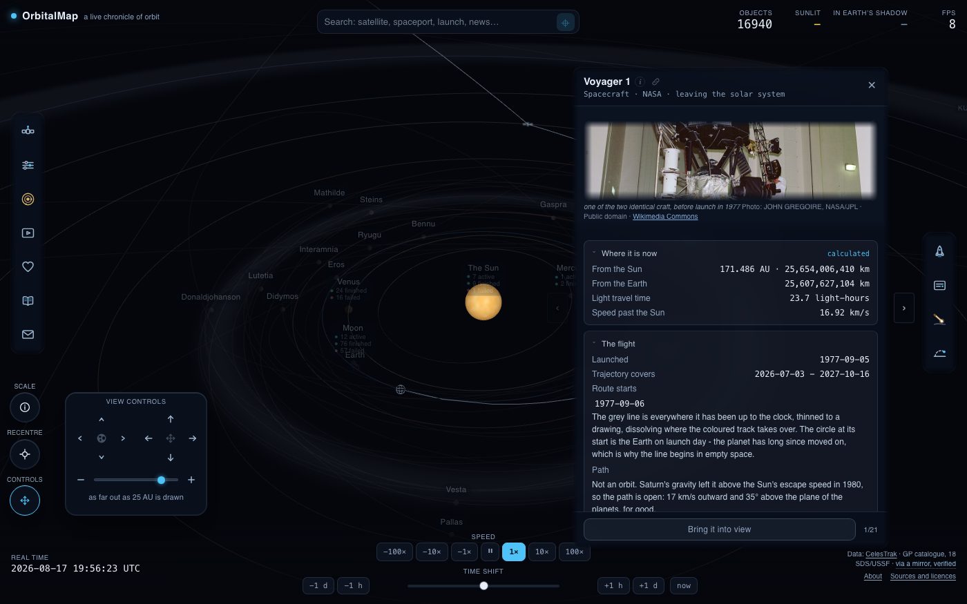
The button on the left edge says where you are and offers everywhere else. It opens a short list of places - the Earth, the Solar System, and each world that has anything in it - with the number of craft at each, so the choice is made on what is there rather than on a name. Choosing the Solar System opens a second picture of the same sky: the Sun, the planets, the dwarf planets, the asteroid belt, the Kuiper belt, and the spacecraft out there whose trajectories have been published. The clock at the bottom still rules it, so the whole system runs on the same date the globe was showing.
Nothing here could be drawn to scale and still be seen. Each distance from the Sun is squeezed by a square root, which pulls the outer planets close enough to reach with the zoom without piling the inner orbits on top of one another. Everything else is honest: the angles are the real angles, each body is tilted the way it really is tilted, and every figure quoted in kilometres is the measured one. There is no scale bar, deliberately - a bar would promise a ruler this picture does not have.
Every body out here has a card of its own - the Sun, the planets, their larger moons, the dwarf planets: how big it is, how far out it goes, how long its day and its year run, what it is made of and what is known to be flying there. Under the figures are the recent headlines that mention it, which is the same press the news panel carries, narrowed to that one world. The cards page with the arrow keys, and the foot of each one says which of them you are on.
Moving around out here works the way a map does. The wheel zooms towards whatever is under the pointer, so the planet you are aiming at is the one you arrive at, and pinching does the same about the point between two fingers. Dragging turns the view, which is how you read the depth of a picture drawn on a plane; hold shift or use the right button to slide the whole picture instead, which the second cross on the camera pad also does without a modifier. However far you have shoved the picture, the recentre button in the corner brings it back to what the view was following.
Where a spacecraft has been
Pick a spacecraft and its route appears: a faint line for the whole journey, and a brighter one for the part already flown by the date on the clock. Those lines are not sketches. Each is tabulated from a trajectory published by NASA/JPL Horizons, with extra readings taken wherever a gravity assist turns the path too sharply for a daily one to follow, so a flyby bends the way the published solution says it bent.
The card lists the dated days along the way - a launch, a flyby, an arrival, a last signal. Click one and the view goes to the place the craft was on that day. Where an ephemeris simply does not exist, the card says so and nothing is drawn. Every position drawn here comes from a published solution; the ones after the date the file was built are that solution's prediction rather than a measurement.
Worlds, and rovers on the ground
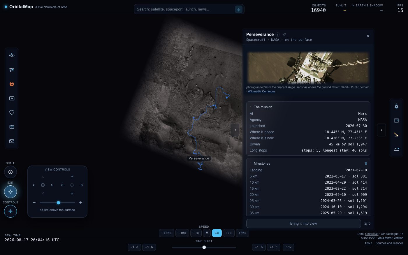
Zoom into a planet and it opens as a world of its own: the globe at its true radius, its moons, and the craft that stay with it, each orbit at the height it is really flown at. An orbiter two hundred kilometres up hugs the disc, because that is what two hundred kilometres looks like against a planet three thousand across. Wind back out and the Solar System is handed back, compression and all. Each world keeps its own answers to the settings and its own filters, exactly as the Solar System and the globe do, so the tracks you asked for at Mars are still there when you come back to it and are not imposed on Jupiter. A world you have not set up inherits what you chose out in the system, with one exception: the fly-around always starts at its slowest in a world, because a speed that reads as a slow survey of the whole system throws a planet's surface past the camera.
A rover is drawn on the ground it actually drove over, turning with the planet under it. Every waypoint is a place the rover stood, published by the people who drove it there, and the line stops at the date on the clock. Where it sat still for a long while, the stop is marked. The whole traverse is a few pixels of a planet a few hundred pixels wide, and that is the true size of it.
Click a stop and it opens a card of what the rover sent from there: the frames themselves, the camera that took each one and the sol it was taken on, with arrows to leaf through the rest. A raw frame is a work of the mission and free of copyright, and the link under it goes to the whole of that sol in the mission's own catalogue, which holds far more than the few kept here.
Where a world has been properly surveyed, you can choose what it is drawn with. Mars can wear the Viking photographs, the Moon the heights LOLA measured, Jupiter the day Cassini mosaicked its belts. The choice is remembered per body, and the panel says which of them you are looking at, because a colour map of heights is not a photograph and the difference matters. The Sun opens the same way and is the one world with nothing to photograph: its face is drawn from the physics of granulation rather than copied from a telescope, so what you see there is an impression of the surface and not today's picture of it.
Moving in time
The bar along the bottom moves the whole page - orbits, shadow, weather and launches together - up to a fortnight either way, at anything from real time to a hundred times faster. A fortnight is as far as this page is willing to go: the further a position is propagated from the date its orbital elements were measured, the less it is worth, and the track stops rather than draw something nobody can stand behind. The button marked “now” returns to the present.
The screensaver
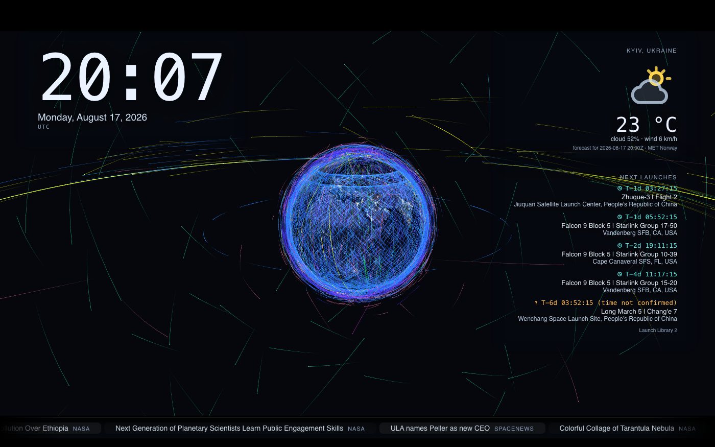
The button in Settings, under Screensaver, or the c key, clears the interface away and leaves the globe, a clock, the weather where you are and the next launches. It can also start on its own after a chosen idle time, and what it shows is yours to choose in the same place. To come back, press Stop in the corner of the picture, the c key again, or Escape.
Sending someone here
The address bar keeps up with the picture. Choose a satellite and it carries the catalogue number; walk out to the Solar System, open Mars, pick the rover on it, and the address says all three. Copy it and whoever opens it lands in the same place - at their own present, because the address holds where you were looking and not when. Nothing about the camera is in it either, so a link is a subject rather than a photograph. It replaces the entry it came from rather than stacking, so the Back button leaves the page instead of walking back through everything you clicked on the way.
In a headset
The picture goes in and the page stays out here, so a panel that follows your hands carries what the rails carry on screen. Everything else is the controllers, and it is the same in both pictures.
- Trigger
- press whatever the beam is on
- Trigger, held
- turn the picture
- Grip
- carry the picture with your hand
- Both grips
- pull your hands apart to come closer
- Thumbstick, forward and back
- closer, and further away
- Thumbstick, sideways
- slide the picture
- Thumbstick, over a list
- scroll the list
- A press on the glass, drawn back
- scroll a list by hand
- A or X
- put the camera back, or let go of what it is following
- B or Y
- put the menu away, and bring it back
Keys
- /
- jump to the search box
- Esc
- close what is open, then release the camera
- ← →
- page through the cards of a list
- , .
- step an hour, or a day with Shift
- k
- pause the clock
- c
- the screensaver
Language, and what is kept
The map reads in every language listed at the top of Settings, and each one has an address of its own. Your settings and the copies of the data the page has fetched are kept in this browser and sent nowhere, and Settings will delete the lot on request. This site sets no cookies of its own. Page views are counted by Cloudflare, which is told the address of the page, the page that sent you and how fast it loaded, and nothing that would name you or follow you anywhere else.
What the things themselves are
Sources and licences
Every figure on this map that was measured is credited to whoever measured it, under the terms they publish it on. None of the organisations listed is connected with this project or endorses it.
Support the site
Write to us
Found a mistake in the data, hit a fault, or have something to
suggest - write. A person answers, usually within a week.